12 Best Hikes In Switzerland (+ Maps & Instructions) | Anywhere We Roam
The hiking in Switzerland is some of the best in the world. Enjoy dramatic views along scenic ridgelines, or easy strolls on grassy meadows to pretty villages. Here is our guide to the best hikes in Switzerland.
With 48 mountains over 4,000 metres, sheer-sided valleys, and spellbinding lakes, the hiking in Switzerland is dramatic.
But this is a land of diversity and there’s something for almost every hiker.
Take a simple stroll on a high ridgeline, or tackle a tricky traverse on exposed trails. Enjoy a 2-hour walk to the grandest scenery in Switzerland, or embark on an all-day challenging hike.
For the hikes in this guide we have used cable cars, cog trains, and funiculars to cut down the effort of getting to some remarkable places.
All of these top hikes in Switzerland include maps and trail instructions.
COMMENTS // We do our best to keep the information in this guide up to date, if you notice anything has changed, please leave a comment below.
BOOKINGS // Booking your trip via the links in this guide will earn us a small commission, at no extra cost to you. Thanks for your support – Paul & Mark.

IN THIS GUIDE
BEST HIKES IN SWITZERLAND
MAP – BEST HIKES IN SWITZERLAND
The below map has the location of the 12 best hikes in Switzerland.
Most of our hikes are centred around three different areas – Zermatt, Berner Oberland, and Appenzell.
- Zermatt is great for high-altitude hikes under the Matterhorn. Read more in our guide to the best hikes in Zermatt.
- The Bernese Oberland is great for scenic hikes among steep-sided valleys, turquoise lakes and pretty villages. Read more in our guide to the best hikes in Bernese Oberland.
- Appenzell is not so well known, but the serrated rocky ridges rising above grassy meadows are perfect for hiking. Read more in our guide to Appenzell.
How to use this map / Click on the top left of the map to display the list of locations, then click on the locations to display further information. Click on the top right corner of the map to open a larger version in a new tab or the star to save to your Google Maps.
HOW LONG DO YOU NEED?
If you are planning a hiking holiday in Switzerland, we recommend focusing on these three regions.
In 7 days, you could visit two of the three areas, in 10 days you can visit all three. If you have 2 weeks, and get lucky with the weather, you could complete the first 10 hikes in this list.


1 – RIFFELSEE TRAIL, ZERMATT
This is the best easy hike in Switzerland.
It has excellent views from beginning to end and requires very little effort.
Take the train to the top of Gornergrat – a beautiful twisting train ride from Zermatt.
At the summit, an observation platform peers over the snarling snout of the Gorner Glacier. Watch as it winds around Dufourspitze, which at 4,634m, is the highest mountain in Switzerland.
The trail heads down to Riffelsee, where you can photograph the Matterhorn reflection. Continue on to the cable car at Riffelberg.
The wonderful thing about this hike is that the Matterhorn is in front of you all the way. In summer, Alpine flowers surround the path.
It takes less than 2 hours and it’s almost entirely downhill.
ROUTE DETAILS // RIFFELSEE
Distance – 4.8 kilometres (3 miles) | Time – 1 hour and 30 minutes | Elevation – 100 metres (330 feet) ascent and 450 meters (1,500 feet) descent | Difficulty – Easy | Start – Gornergrat | End – Riffelberg | Map – Orange trail


2 – HÖRNLIHÜTTE HIKE, ZERMATT
This out-and-back walk is one of our favourite hikes in Switzerland.
The destination is Hörnli Hut, base camp for the Matterhorn summit climb.
The trail begins at Schwarzsee and works its way up a series of ridges to the hut. There are a few metal staircases and a very short narrow section where a head for heights is useful. Otherwise, there is nothing technically difficult.
The 700 metres of ascent and descent requires a reasonable level of fitness, but the hut is well position for a midway break.
The views are sensational, but the real thrill is the sheer sense of adventure in a rugged and wild Alpine scene.
At the hut, keep an eye out for climbers preparing to summit the next day and bring some binoculars. There may be a few climbers still on the impossibly narrow looking ridge to the top.
ROUTE DETAILS // HÖRNLIHÜTTE
Distance – 8.6 kilometres (5.3 miles) | Time – 4 hours | Elevation – 695m (2,280 ft) ascent and descent | Difficulty – Moderate to Challenging | Start – Schwarzsee | End – Schwarzsee | Map – Brown trail


3 – EDELWEISS TRAIL (HÖHBALMEN), ZERMATT
One of the best views of the Matterhorn is from Höhbalmen Meadows. The only way to get there is on the Edelweiss Trail hike.
It starts from Zermatt Village and climbs up to Edelweiss Hut. After the hut there’s a strenuous climb (with little relief) to Trift Guesthouse.
This makes a great place to stop with two thirds of the ascent out of the way. They also do an excellent iced tea.


From here the path continues to rise, contouring a grassy slope. Suddenly the Matterhorn appears ahead, stretching above Höhbalmen meadow.
From here, the trail descends gradually with the Matterhorn in front of you all the way.
After about 4 kilometres it drops down into the valley, passes the Arbebach Falls and follows the left-hand side of Zmuttbach into Zmutt. Another great spot for a break.
This hike is not to be underestimated. It’s over 20 kilometres and takes about 7 hours with 1,200m of ascent and descent. However, it’s one of the most exhilarating hikes in Switzerland.
ROUTE DETAILS // EDELWEISS TRAIL
Distance – 20.7 kilometres (12.85 miles) | Time – 7 hours and 30 minutes | Elevation – 1,200m (3,940 ft) ascent and descent | Difficulty – Challenging | Start & End – Zermatt | Map – Red trail


4 – BREITHORN ASCENT, ZERMATT
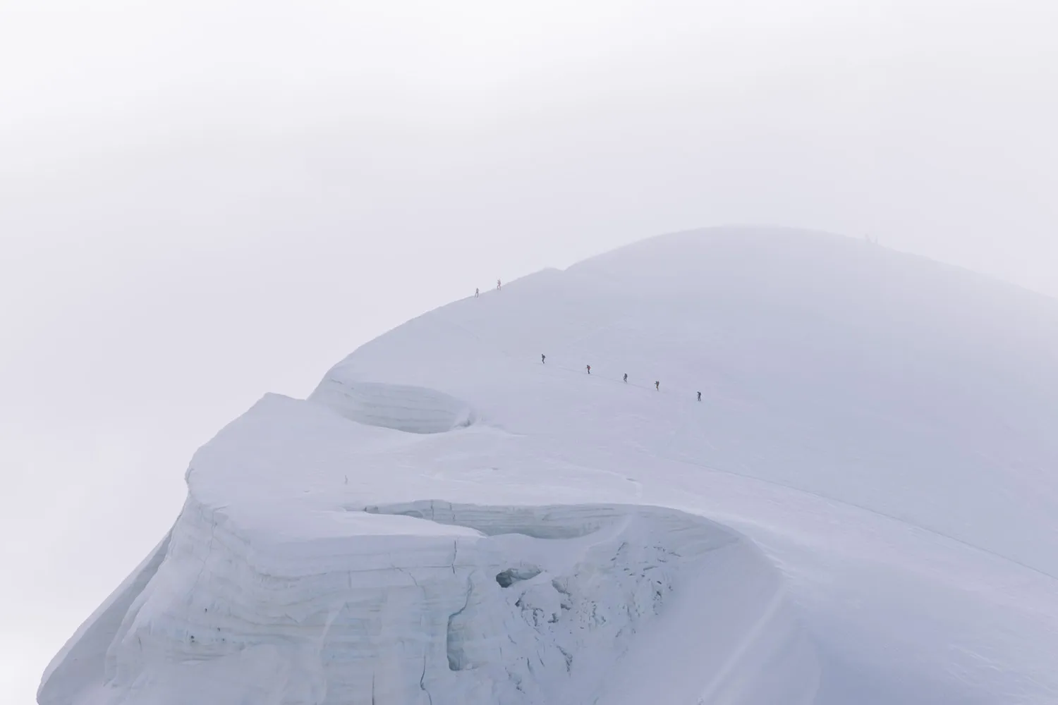
This hike takes you to the summit of Breithorn, an altitude of 4,164m.
It’s rare to be able to walk to the top of a 4,000-metre mountain with so little effort. Breithorn is the perfect way for first timers to get an idea of what it is like to trek in high Alpine ice.
The trail begins at Klein Matterhorn (Matterhorn Glacier Paradise cable car station). It ascends just over 400 m to the glaciated summit.
The views all along the way are sensational, including the Matterhorn and the peaks of Castor and Lyskamm.
The return journey takes just over three hours.
Although it’s only a little over three miles, the altitude and snow make it harder going than a regular hike of the same distance.
You’ll need a guide, as the route changes regularly. Book a Breithorn guided tour and have a once-in-a-lifetime experience.
ROUTE DETAILS // BREITHORN ASCENT
Distance – 5.4 kilometres (3.4 miles) | Time – 3 hours and 30 minutes | Elevation – 415m (1,360 ft) ascent and descent | Difficulty – Moderate | Start – Klein Matterhorn | End – Klein Matterhorn | Map – Black trail


5 – MÄNNLICHEN TO ALPIGLEN, BERNESE OBERLAND
This wonderful hike combines three shorter trails and collects many of the best views of the Berner Oberland region.
It begins at the Männlichen Cable Car Station. From here, you can take an optional detour to the top of Männlichen for excellent views of the Lauterbrunnen Valley.
Next, the trail follows the Männlichen Panoramaweg. This path traverses under the ridgeline towards Kleine Scheidegg. Glorious views of the three mighty peaks of Eiger, Mönch, and Jungfrau tower in front of you.
At Kleine Scheidegg the path follows the Jungfrau Walk, climbing up to Eigergletscher.
From here it follows the Eiger Trail, which traverses under the mighty north face of the Eiger.


It ends at Alpiglen Train Station where you can return to most destinations in the Berner Oberland region.
There is nothing technically difficult on this walk and all the trails are well signed. Restaurant Grindelwaldblick is our choice for lunch. It has a little watchtower to catch the best of the views.
ROUTE DETAILS // MÄNNLICHEN TO ALPIGLEN
Distance – 13.25 km (8.25 miles) | Time – 5 hours | Elevation – 340 metres (1,115 feet) ascent and 945 metres (3,100 feet) descent | Difficulty – Moderate | Start – Männlichen | End – Alpiglen | Map – Blue, peach, and light green trails


6 – SCHYNIGE PLATTE TO FIRST, BERNESE OBERLAND
If we had to choose one walk as the best hike in Switzerland, this would be it.
It combines two popular walks, the Schynige Platte Panoramaweg and Faulhornweg. Along the way you’ll encounter grand views of 4,000-metre peaks, turquoise lakes, a lofty summit, a hanging walkway, and a charming mountain hut.
The hike begins at the Schynige Platte Cog Railway Station. The trail follows the Panoramaweg towards Daube and Oberberghorn with wonderful views of Lake Brienze.
At Loucheron the Panoramaweg meets up with the Faulhornweg and starts to climb.


The trail winds past a massif cliff face to reach Männdelen Hut. From here, the walk contours under the mountaintop before suddenly appearing on the ridgeline. Magnificent views of multiple 4,000-metre peaks dominate the skyline.
A stiff climb brings you to the top of Faulhorn (2,681m), where a charming hut is the ideal place to stop for lunch. It’s now a gradual descent to Bachalpsee then onto First.
The day ends with a scenic ride on the Grindelwald-First cable car to Grindelwald.
There is nothing technically difficult on this trail, but it’s considered challenging because of the distance, and the total ascent of 1,000 metres.
Tip | Get one of the first two trains to Schynige Platte to allow plenty of time.
ROUTE DETAILS // SHYNIGE PLATTE TO FIRST
Distance – 16.5 kilometres (10.25 miles) | Time – 7 hours | Elevation – 940 metres (3,080 feet) ascent and 740 metres (2,430) descent | Difficulty – Challenging | Start – Shynige Platte | End – First | Map – Orange, red, and yellow trails


7 – OESCHINEN LAKE PANORAMA TRAIL, BERNESE OBERLAND
Oeschinen Lake is one of the most beautiful in Switzerland.
Blue-green waters are surrounded by 3,500-metre-high jagged peaks that rise from its shores. The entire area looks like a massive cauldron of ice and rock. When the sun is shining, its turquoise waters appear incandescent.
A trail called the Panoramaweg winds its way above the lake providing breath-taking views.
The hike can be undertaken by anyone with a reasonable level of fitness and the trail is easy to follow and well signed.
Although it’s a little out of the way, it’s worth the effort to get there.
You can read all about it in our Oeschinen Lake Panoramaweg guide.
ROUTE DETAILS // OESCHINEN LAKE
Distance – 8.5 kilometres (5.25 miles) | Time – 3 hours and 45 minutes | Elevation – 420 metres (1,375 feet) ascent and descent | Difficulty – Moderate | Start & End – Oeschinen Cable Car Station | Map – Aubergine trail


8 – SHAFLER RIDGE HIKE, APPENZELL
This magnificent hike is a fantastic exploration of all that is great about the Appenzell region. Experience the spiky ridges, the best lakes, exposed trails, and stunningly situated huts.
It begins at the Ebenalp Cable Car Station, follows the top of the ridge to Chlus. From here, the hike continues up to the Shäfler Hut. (Alternatively, you could take the even better, but longer, route via Aescher Hut)
From Shäfler Hut it gets a bit tricky. Heading along the narrow ridge, the path makes a descent with near-vertical drops on one side. Handrails are provided in places. You should not attempt it after rain and it’s not good for anyone with a fear of heights.


After about half an hour the exposed section comes to an end. The trail makes a lovely traverse under the spiky ridge before bearing left and descending to Mesmer Hut. Take a break and recharge before the next descent down a series of zigzags to Seealpsee.
Finally, progress on to Wasserauen.
The entire hike is about 5 hours of walking time, but you’ll want longer to take breaks and soak in those views. There are plenty of great huts at regular intervals along the way.
ROUTE DETAILS // SHAFLER RIDGE
Distance – 12 kilometres | Time – 5 hours | Elevation – 630m ascent and 1,350m descent | Difficulty – Medium to Challenging and not for those with a fear of heights | Map – Marked in purple on the map below.


9 – SAXER LÜCKE PANORAMA, APPENZELL
For the first three to four hours this hike has wondrous views taking in the Saxer Lücke viewpoint and Fälensee Lake.
It begins at the top of the Hoher Kasten Cable Car Station and descends via zigzags to a saddle on the ridge. Turn left following signs to Staubern. From here the trail rises and falls, sometimes staying below the ridge and sometimes on top.
After about 2 hours you reach Staubern Hut, from where you should follow signs to Saxer Lücke (1 hour, 20 minutes).


The trail heads under a wall of rock before rising again to the top of the ridge. Magnificent views of Saxer Lücke and Fälensee stretch out before you.
The path now zigzags steeply to Bollenwees Hut on the edge of Fälensee. Take in the views and have a well-deserved break before following the long path back to Brülisau. We should point out that the path gets a little boring towards the end.
There is nothing technically difficult on this hike and there are no nasty exposed paths. But it’s a long day in the mountains and requires a good level of fitness.
Saxer Lücke is similar to one of our other favourite hikes in Switzerland, the Panorama hike at Oeschinen Lake.
ROUTE DETAILS // SAXER LÜCKE PANORAMA
Distance – 17 kilometres | Time – 6 hours | Elevation – 450m ascent and 1,275m descent | Difficulty – Medium to Challenging | Map – Marked in grey on the map below (go clockwise).


10 – ALETSCH GLACIER PANORMA TRAIL, BRIG
The entire Aletsch Glacier Panoramaweg takes three days, but this middle section can be done as a day hike, using cable cars at the beginning and the end.
In one direction it offers unparalleled views of the Aletsch Glacier. At 22 kilometres, it’s the longest glacier in the Alps. In the other direction, you’ll be in awe of the snow-capped peaks of the Valais.
The trail begins by circling the peak of Eggishorn. Next it passes through a 1-kilometre tunnel (bring a torch) and descends to Märjelensee, a collection of pretty lakes.
The path now has wonderful views over the Aletsch Glacier with the Jungfraujoch and Mönch mountains in the distance.

The trail ascends to a series of viewpoints under Bettmerhorn then along the Härdnergrat Ridge to Riederalp.
The route we have chosen is just over 10 miles. There is nothing technically difficult, but the length makes it moderately challenging.
Reducing the distance — If you want to experience the best of the walk over less miles, take the cable car from Bettmergrat to Betten Talstation. See the route on the map below.
Eggishorn Views — It’s well worth taking the cable car up to Eggishorn then coming back down to Fiescheralp to start the hike. The views are incredible.
ROUTE DETAILS // ALETSCH GLACIER PANORMA
Distance – 16.5 kilometres (10.25 miles) | Time – 6 hours and 15 minutes | Elevation – 500 metres (1,640 feet) ascent and 700m descent (2,300 feet) | Difficulty – Moderate to Challenging | Start – Fiescheralp cable car | End – Riederalp Cable Car | Map – See our Aletsch Glacier Panoramaweg map.


11 – COL SAINT BERNARD HIKE, GREAT ST BERNARD PASS
There are three great reasons to undertake this hike.
Firstly, it begins at the top of the Great St Bernard Pass which connects Switzerland to Italy. This is the 3rd highest pass in Switzerland (2,469m), and the drive to get there is breath-taking,
Secondly the trail begins at the St Bernard Hospice. In summer you can visit the St Bernard dogs and explore a museum dedicated to their role as rescue dogs.
Thirdly it’s a wonderful hike in dramatic high Alpine scenery.

The trail begins at the St Bernard Hospice and heads over two passes to reach a dramatic panorama. Here you’ll get amazing views of Grand Golliat, Mont Dolent, and Mont Blanc.
It then descends to a trio of lakes known as Lacs de Fenêtre that sit on a grassy flower-filled 2,500m high plateau.
The trail then heads over another pass as it makes its way back to the hospice.
Although there is nothing technically difficult on this hike, the ascent of 1,000 metres makes it moderately challenging. There is also the potential for snow on the trail even in mid-July.
ROUTE DETAILS // COL SAINT BERNARD
Distance – 12 kilometres (7.5 miles) | Time – 5 hours and 30 minutes | Elevation – 1,050 metres (3,450 feet) ascent and descent | Difficulty – Moderate to Challenging | Start & End – Grand St. Bernard Hospice | Map – Switzerland Mobility


12 – MUOTTAS MURAGL PANORAMA TRAIL, ST MORITZ
This hike is little more than an afternoon stroll but it’s one of the great hikes in Switzerland.
Set in the mountains above Saint Moritz the day begins with a picturesque funicular ride up to the Muottas Muragl.
From there the well signed trail gently contours around the flanks of the mountain towards Alp Languard.

There is very little ascent and descent. The entire route is blessed with great views down to the Engadin Valley and up to the snow-capped peaks of the Bernina mountains.
Halfway around, the Unterer Shafberg restaurant provides the perfect spot for a break. At the end of the hike, Bergrestaurant Alp Languard has a wonderful shady terrace to soak in the final views.
To end the day, take the chairlift down to Potresina. From here regular bus or trains go back to Punt Muragl or Saint Moritz.
ROUTE DETAILS // MUOTTAS MURAGL PANORAMA
Distance – 6.8 kilometres (4.25 miles) | Time – 2 hours | Elevation – 105 metres (345 feet) ascent and descent | Difficulty – Easy | Start – Muottas Muragl Funicular Station | End – Alp Languard Chairlift | Map – Muottas Muragl Panoramaweg map


BEST TIME TO HIKE IN SWITZERLAND
The summer hiking season in Switzerland runs from mid-June to mid-October. However, early in the season snow often still covers the higher trails and it can return in late September.
Most mountain cable cars and restaurants close for a few weeks between ski season and summer season. This is usually mid-April through mid-June and mid-October to mid-December.
Different regions peak at slightly different times.
With mountain peaks around 3,000 metres, the main season in Zermatt is from early July to mid-September.
Being a bit lower, the Berner Oberland (around 2,500m) season runs from mid-June to end of September.
Appenzell – lower still at around 2,000 metres – has great hiking from the beginning of June to mid-October.

SWITZERLAND CABLE CAR & TRAIN TICKETS
Many of our best hikes in Switzerland require cable cars, trains, or funiculars. If you intend to attempt several over one or two weeks, it is worth considering purchasing a Swiss Travel Pass.
SWISS SAVINGS
SWISS TRAVEL PASS
The Swiss Travel Pass provides unlimited access on trains, buses, and boats throughout Switzerland including panoramic trains.
The Swiss Museum Pass is also included which provides free access to over 500 museums.
SWISS HALF CARD
Purchase train, bus, boat, mountain railways and cable cars at half price with the Swiss Half Card. This is a great opinion if you are driving yourself but intend on using cable cars.

THANKS FOR VISITING // WHERE NEXT?
A BIG THANK YOU
We’ve been providing free travel content on Anywhere We Roam since 2017. If you appreciate what we do, here are some ways you can support us.
Thank you!
Paul & Mark
FOLLOW US ON INSTAGRAM
USE OUR RESOURCES PAGE

