6 Circular Walks In The Cotswolds + Maps & Instructions
The Cotswolds is classic English countryside and the best way to explore the area is on foot. Here are our 6 favourite circular walks including maps and instructions.
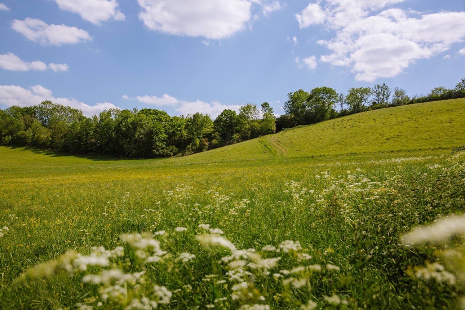
The English countryside conjures up images of rolling green hills and chocolate box cottages. And nowhere brings this more to life than the Cotswolds. Here, in the heart of England, babbling brooks wind through golden-hued villages, wooded glens and meadows speckled with sheep.
There’s no better way to explore than by strapping on your hiking boots and wandering this idyllic countryside on foot. Take in expansive views; stroll from one picture-perfect village to the next; have a pint in a country pub and enjoy a beautiful part of England.
There are hundreds of public footpaths in the area, so we’ve selected our favourite circular walks in the Cotswolds that showcase the wide range of countryside. We have some easy strolls for the whole family, through to challenging hikes with impressive views. Three of these circular walks explore part of the Cotswolds Way, and the other three visit beautiful villages.
Each circular walk has our tailored maps which you can download to your device and take with you.
For more hiking inspiration, read our guide to the best walks from central London.
Booking your trip via the links on this page (or on our book page) will earn us a small commission, at no extra cost to you. Thanks for your support – Paul & Mark.

COTSWOLDS WALKING MAP
We have created maps for each of the hikes in this article which include step-by-step hiking instructions. You can find the maps linked under the description of each of the walks. Click on the numbered marker on the map to read our hiking instructions. Either tap on the number twice or tap once and scroll the marker tab upwards to display the instructions.
How to use this map / Click on the top left of the map to display the list of locations, then click on the locations to display further information. Click on the top right corner of the map to open a larger version in a new tab or the star to save to your Google Maps.
WHERE TO STAY IN THE COTSWOLDS
There are a number of different regions in the Cotswolds, all of which make a great base for some of the best weekend breaks in the UK. The best area for hiking and the outdoors is around Broadway which is near where the Cotswold Way circular walks start and finish.
Alternatively, for hiking from one beautiful village to the next, the area around the Slaughters is a good option.
For all our accommodation tips, read our article on the best places to stay in the Cotswolds.
HOW TO GET AROUND?
The Cotswolds is a large area and many of our favourite walks are spread out. To get to most of these walks, you will need a car. We recommend booking your car hire with rentalcars.com who compare prices across all the major hire car companies.

1 – BROADWAY TOWER CIRCULAR WALK
Start – Broadway Village Leamington Car Park | Distance – 6.6-kilometre circuit | Time – 2 hours 15 minutes | Elevation – 220 metres ascent and descent | Difficulty – Easy to Medium | Directions – Follow our Broadway Tower walk map
On the western side of the Cotswolds, the escarpment (a steep hill about 200 metres high) marks the boundary between the Cotswold Area of Outstanding Natural Beauty and the Severn Valley. While it may not have the drama of the Seven Sisters cliffs, the escarpment is excellent hill-walking country and the views from the top are outstanding.
Three of our best walks in the Cotswolds make use of the Cotswold Way – this is one of them.
It begins and ends in the village of Broadway – a posh Cotswolds village – which is famous for Broadway Tower, the second-highest spot in the Cotswolds. Perched on top of the escarpment, majestic views over countless ridges glimmer on the horizon.
The walk itself is just under 7 kilometres long and has two short steep sections ascending and descending the escarpment. The path is easy to follow and takes about 2 hours and 30 minutes. Make sure you leave time to explore Broadway..
With so much going on in the area, this is a great base for spending a weekend in the Cotswolds.
HIGHLIGHTS
This is the best Cotswolds walk for magical views from the top of a hill with good facilities for a family picnic near the picturesque Broadway tower.
MAP | BROADWAY TOWER CIRCULAR WALK MAP


2 – CASTLE COMBE & AROUND
Start – Castle Combe Car Park | Distance – 9-kilometre circuit | Time – 2 hours 45 minutes | Elevation – 150 metres ascent and descent | Difficulty – Easy to Medium | Directions – Follow our Castle Combe walk map
There are plenty of pretty places to visit in the Cotswolds, but Castle Combe is perhaps our favourite. Nestled in green valley walls it has everything that makes a Cotswold village special: an old pub, a grand manor house, a lovely church and a babbling brook.
Most importantly, the locals have kept it largely car-free so you can capture the village in much of its pre-industrial age glory. It’s a beautifully set location and the surrounding countryside is perfect for a stroll.
This walk starts and ends in Castle Combe but in between, it passes through rolling English countryside. The path follows a meandering river, slowly rising into a forest before arriving in the hamlet of Long Dean. Bending right it ascends up a banked leafy trail, then crosses fields before returning via a wooded glen. Just before arriving back in Castle Combe, the manicured golf course provides excellent views of the manor house, church and village.
It’s a beautiful walk that is perfectly capped off by a drink at the Castle Inn or White Hart pub in the village market square.
HIGHLIGHTS
This is one of the best walks in the Cotswolds for exploring a pretty village surrounded by lush green countryside. Don’t miss the views over Castle Combe from the golf course, but keep an eye out for flying balls.
MAP | CASTLE COMBE CIRCULAR WALK MAP


3 – CLEEVE HILL VIA BELAS KNAP
Start – Stockwell Lane Car Park in Cleeve Hill | Distance – 14.2 km circuit | Time – 4 hours 20 minutes | Elevation – 300 metres ascent and descent | Difficulty – Strenuous | Directions – Follow our Cleeve Hill hike map
While most of the Cotswolds is rolling green countryside and pretty little villages, this walk is more rugged and diverse. Its focal point is Cleeve Hill – the highest point in the Cotswolds at 330 metres. But what makes it special is the large common that covers the top. Unlike anywhere else in the area, it’s remarkable for its desolate appearance.
This walk also visits the Neolithic burial mound of Belas Knap, drops into woods, runs along a river and collects the charming town of Winchcombe.
At times the trail meanders through the rolling countryside familiar to the Cotswolds; at others, it’s more reminiscent of the Lake District.
At 15 kilometres with 300 metres of ascent, it’s the most challenging of all our walks in the Cotswolds. Allow 5 hours to complete the walk, have a picnic and savour the wide-ranging views. From the top of the common, the Malvern Hills, Black Hills, Cheltenham and even the Severn Bridge are visible. As you descend, Sudeley Castle glimmers next to the attractive town of Winchcombe.
HIGHLIGHTS
This is the best Cotswolds walk for the wildest and most rugged hiking possible in the area. Take a break at the Neolithic (New Stone Age) burial mound of Belas Knap.
MAP | CLEEVE HILL CIRCULAR WALK MAP


4 – BOURTON, SLAUGHTERS & NAUNTON
Start – Bourton-on-the-Water car park | Distance – 17-kilometre circuit | Time – 5 hours | Elevation – 150 metres ascent and descent | Difficulty – Medium to Strenuous | Directions – Follow our Bourton to Slaughters hike map
This is one of the classic circular pub walks in the Cotswolds.
It traverses green rolling hills, two charming river-cut valleys and four of the most beautiful villages you’re likely to find anywhere in the country. There is simply no other circular walk that better captures the unique aesthetic of the Cotswolds.
It begins in Bourton-on-the-Water, where the River Windrush rolls past a mix of old tea houses and trendy bakeries.
Leaving the town, it follows the Warden’s Way to Lower Slaughter and Upper Slaughter.
The Slaughters have had no building since 1906 and are immaculate. Untouched for over a century, the River Eye (a tributary of the River Windrush) winds its way through beautiful honey-coloured cottages and cute churches with little bridges dotted along the brook.


After the Slaughters, the trail rises over fields and drops into Naunton, another charming village. Take a break at the Black Horse Inn and snoop around the stunning houses and gardens that surround the village church. Leaving Warden’s Way, the trail now joins the Windrush Way as it slowly follows the River Windrush while it meanders back into Bourton-on-the-Water.
In our opinion, this is the best walk in the Cotswolds to collect gorgeous villages set on tiny rivers in rolling countryside. Exactly what the Cotswolds are all about.
HIGHLIGHTS
The is the best walk in the Cotswolds for a village-to-village hike collecting some of the most charming places in the area. Don’t miss the riverside setting below the church in Upper Slaughter.
MAP | BOURTON TO SLAUGHTERS CIRCULAR WALK MAP

5 – MINSTER LOVELL RUINS WALK
Start – Old Swan Pub | Distance – 5.9-kilometre circuit | Time – 1 hour 45 minutes | Elevation – 40 metres ascent and descent | Difficulty – Easy | Directions – Follow our Minster Lovell hike map
While the escarpment at the western edge of the Cotswolds offers the best rustic walks, the eastern side has idyllic riverside charm. It’s an altogether gentler and slower pace of life making it perfect for simple family strolls, lazy lunchtime picnics and wild swimming.
The Old Swan pub stands at the entrance to Minster Lovell overlooking the River Windrush which arcs around the local cricket pitch. At the other end, a picture-perfect church stands beside the ruins of an old manor house. From here the trail heads down one side of the Windrush valley, before crossing a bridge and returning at a slightly higher elevation.
There are two great spots for a picnic by the river: one under the ruins and another a little further downstream in a meadow. It also has two great wild swimming spots. The first one by the ruined manor house is shallower and slower making it excellent for younger kids. The second is in the reed-fringed pool just downstream of the weir. Here the current is strong enough and water deep enough to give you a proper workout. (Picnic and swimming spots are marked on the map).
All in all, it’s a great way to while away a few hours on a hot summer’s day. A pint at the Old Swan is a great way to finish an excellent day out.
HIGHLIGHTS
This is the best Cotswolds walk for a family stroll in a beautiful setting with an excellent option for safe wild swimming. A picnic on the grassy banks after a walk and a swim is a great way to watch the sun go down.
MAP | MINSTER LOVELL CIRCULAR WALK MAP


6 – STANTON-SNOWSHILL PUB TO PUB
Start – Stanton Car Park | Distance – 11-kilometre circuit | Time – 3 hours 30 minutes | Elevation – 210 metres ascent and descent | Difficulty – Medium | Directions – Follow our Stanton-Snowshill hike map
This Cotswold Way circular walk visits the top and the bottom of the escarpment and makes for an excellent day out in the Cotswolds. Like the others, it has sweeping views of the surrounding countryside. But it also passes through two beautiful villages, both of which have great pubs that are perfectly positioned for a midway refreshment and an end-of-walk reward.
It begins in the village of Stanton, and then rises up the Cotswold’s Way to the top of the escarpment. It’s 200 metres of ascent, but all the hard work is out of the way quickly.
Once over the top, the village of Snowshill shimmers on the hill opposite you. Set around a church in the middle of a triangular green, it’s not much more than a small collection of cottages but the local pub serves ale produced at the Donnington Brewery and it’s worth a pitstop.
From Snowshill, the trail winds its way around the escarpment collecting fine views before dropping back into Stanton. There’s no better way to end a Cotswold walk than at the local Mount Inn, where you’ll find other hikers exhaustedly nursing a pint while relaxing aching limbs.
HIGHLIGHTS
This is the best Cotswolds walk for an energetic hike with a pint in a perfectly positioned pub at the end. The Snowshill Manor & Gardens are an interesting place to visit with oddities collected by its eccentric owner.
MAP | STANTON TO SNOWSHILL CIRCULAR MAP

THANKS FOR VISITING // WHERE NEXT?
A BIG THANK YOU
We’ve been providing free travel content since 2017, helping our readers explore new and familiar destinations.
Following us on social media, using our resource page or buying us a coffee, helps keep Anywhere We Roam on the road.
Thanks for your support, Paul & Mark.


