Best Grand Canyon South Rim Hikes: Easy To Challenging | Anywhere We Roam
Our guide to the best day hikes from the Grand Canyon South Rim includes route descriptions, maps, and safety tips. There’s a hike for anyone so take your pick and have a great day out.
LAST UPDATE: 21 Jan 2024
Anywhere We Roam is reader-supported. When you buy through links on our site, we may earn a small affiliate commission at no extra cost to you. Thanks for your support – Paul & Mark.
Stretching along a 278-mile section of the Colorado River and extending up to 18 miles wide at its maximum width, the Grand Canyon is the largest canyon in the world.
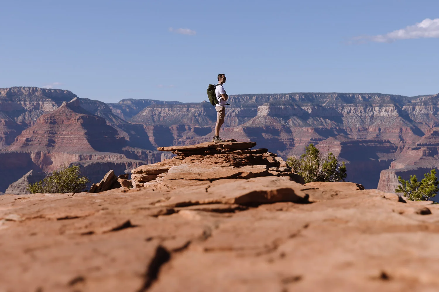
Grand Canyon viewpoints are dotted along the north and south rim. But to truly appreciate this magnificent natural wonder, its best to strap on those hiking shoes and take to the trails.
The best Grand Canyon hiking is around Grand Canyon Village on the South Rim. There’s a trail here for almost anyone of any ability.
Easy hikes stick to the rim taking in commanding viewpoints, medium trails descend to the outer canyon and challenging ones descend all the way to the inner canyon.
This guide covers the best day hikes at the South Rim. It includes a description of each hike, maps and safety tips from the National Park Service.
Travel update: Bright Angel Trail will be mostly closed between December 1, 2023, and April 14, 2024.

GRAND CANYON SOUTH RIM HIKING MAP
Below is a map of the best day hikes from Grand Canyon South Rim so you can see where they are all located. The walks use five different trails:
- South Rim Trail – Orange
- Bright Angel Trail – Red
- South Kaibab Trail – Purple
- Grandview Trail – Brown
- Shoshone Trail – Blue
The distances of each walk are for the complete round trip hike and the elevation is the difference in altitude between the lowest and highest part of the hike.
How to use this map / Click on the top left of the map to display the list of locations, then click on the locations to display further information. Click on the top right corner of the map to open a larger version in a new tab or the star to save to your Google Maps.
EASY GRAND CANYON DAY HIKES
These easy hikes are less than 2 miles, involve less than 800 feet of ascent and descent, and take under 2 hours. These walks can be undertaken by almost anyone, although the hike to Ooh Ahh Point requires a moderate level of fitness.
MEDIUM GRAND CANYON DAY HIKES
These medium hikes are between 3 and 5½ miles long, involve less than 1, 600 feet of ascent and descent, and take between 2 to 4 hours. These hikes can be undertaken by regular hikers with a decent level of fitness and comfortable footwear.
CHALLENGING GRAND CANYON DAY HIKES
These challenging hikes are over 5½ miles long, involve over 2,000 feet of ascent and descent and take more than 4 hours. You should be an experienced hiker with a good level of fitness and proper hiking boots or shoes.


EASY
1. POWELL POINT TO MOHAVE POINT
- Distance – 1.6 miles (point to point)
- Time – 45 minutes
- Elevation change – 70 feet descent
The South Rim Trail follows the southern edge of Grand Canyon for 13 miles between the South Kaibab Trailhead and Hermits Rest. Shuttle buses head up and down the route, so you can pick a small section of the trail for an easy hike.
This easy Grand Canyon hike follows the trail between three of the best Grand Canyon viewpoints – Powell Point, Hopi Point and Mohave Point. The walk only takes 45 minutes and slowly descends downhill, so you get amazing views for very little effort.
At Mohave Point the buttes and mesas are particularly striking, and if you look carefully, you can see the water surging over Salt Creek, Granite, and Hermit rapids.
When – This is a great hike to do just before sunset.
Getting to the Trailhead – Take the shuttle bus (red route) from Grand Canyon Village to Powell Point to start the walk. At the end of walk, get the shuttle bus from Mohave Point back to Grand Canyon Village. From December to March, you can also drive your own vehicle.
Facilities – Restrooms at Hope Point.


EASY
2. SHOSHONE POINT
- Distance – 2-mile round trip (1 mile each way)
- Time – 50 minutes
- Elevation change – 50 feet ascent and descent
Shoshone Point is hands down our favorite Grand Canyon Viewpoint. Not advertised by the authorities and often missing on maps, it is a peaceful and serene location with views in all directions.
Over the years, it has become an interesting destination for weddings. On our visit, one couple were taking their vows, and another were back to celebrate their 25th wedding anniversary.
The only way to get here is to walk. It’s an easy 25-minute walk from the parking lot through the Kaibab Forest to the lookout. Keep your eyes out for elk.
When – Shoshone Point is a great place to be for sunset.
Getting to the Trailhead – Take Desert View Drive 5 miles east of Grand Canyon Village and park in one of the 20 spaces at Shoshone parking lot (Marked in blue on the map above).
Facilities – None.


EASY
3. SOUTH KAIBAB TO OOH AAH POINT
- Distance – 1.8-mile round trip (0.9 miles each way)
- Time – 1 hour 30 minutes
- Elevation change – 600 feet descent and ascent
There are several trails that descend into the canyon, but many have steep switchbacks, and the views take a while to appear. The South Kaibab Trail is an exception.
This short hike to Ooh Aah Point is the easiest way to get a feeling for what it’s like to descend into the canyon.
The hike begins at the South Kaibab Trailhead, descends a couple of switchbacks, then follows a straighter flatter trail as it heads under the canyon walls.
After just 30 minutes it arrives at Ooh Aah point. From here you get a unique perspective of the buttes and mesas of the Grand Canyon. You can also see the South Kaibab trail below you as it winds its way deeper into the canyon.


This is harder than the other easy hikes from the South Rim because you have to climb back up 600 feet of elevation, but it’s worth the effort.
When – Early morning or late afternoon when the switchbacks are in shade.
Getting to the trailhead – Take the Kaibab South Rim bus (orange line) from Mather Point or the Visitors Centre to South Kaibab Trailhead stop.
Facilities – South Kaibab Trailhead has a restroom and a water refill station (May to October only). There is no water once you leave the trailhead. There is parking at Pipe Creek Vista but it’s 0.75 miles from the trailhead.


MEDIUM
4. POWELL POINT TO PIMA POINT
- Distance – 5.4 miles (point to point)
- Time – 2 hours 30 minutes
- Elevation change – 400 feet descent
This is the best section of the South Rim Trail, covering about half its length. It’s an extension of hike 1 above, starting with Powell, Hopi and Mohave viewpoints, then continuing along the trail to Pima Point.
Along the way it passes the Great Mohave Wall Viewpoint and peers down into the Abyss – the deepest sheer vertical drop on the South Rim.
Pima Point itself sits on a promontory overhanging the canyon. It has an excellent view of the Colorado River set in a deep gash in the canyon. On quiet days, the Granite Rapids can be heard echoing around the canyon walls 4,000 feet below.
The walk is 5.4 miles which can be tiring on a hot day. But the trail is quite easy with almost no uphill and only very gradual descent.
When – Late afternoon for great sunsets.
Getting to the Trailhead – Take the shuttle bus (red route) from Grand Canyon Village to Powell Point. At the end of the hike get the shuttle bus from Pima Point back to Grand Canyon Village. From December to March, you can also drive your own vehicle.
Facilities – There are restrooms at Hope Point.


MEDIUM
5. SOUTH KAIBAB TRAIL TO CEDAR RIDGE
- Distance – 3-mile loop (1.5 miles each way)
- Time – 2 hours, 30 minutes
- Elevation change – 1,150 feet descent and ascent
This is our favorite medium-difficulty day hike from Grand Canyon South Rim. There are three reasons.
Firstly, it uses the South Kaibab Trail which stays higher up on the ridgeline offering better views for longer.
Secondly, it’s less busy than the popular Bright Angel Trail. Thirdly the trail itself is wonderful, especially the section between Ooh Aah Point and Cedar Ridge where the deep red path runs above a narrow ridge.


The only downside is the lack of shade. In spring or fall the temperatures are not too bad, but in summer, this trail can be very hot.
When – Start early morning so you can finish the climb back before it gets too hot.
Getting to the trailhead – Take the Kaibab South Rim bus (orange line) from Mather Point or the Visitors Centre to the South Kaibab Trailhead stop. There is parking at Pipe Creek Vista but it’s 0.75 miles from the trailhead.
Facilities – There are restrooms at South Kaibab Trailhead and Cedar Ridge. The South Kaibab Trailhead has a water refill station (May to October), but there is no water on the trail.

MEDIUM
6. BRIGHT ANGEL TRAIL TO 2 MILE CORNER
- Distance – 4-mile round trip (2 miles each way)
- Time – 3 hours 15 minutes
- Elevation change – 1,360 feet descent and ascent
Bright Angel Trail is the most famous of the trails that descends into the Grand Canyon. From the trailhead at Grand Canyon Village, it is 10 miles and 4,000 feet of descent to reach Phantom Ranch on the banks of the Colorado River.
Unfortunately, the best section of the trail is towards the end as it cuts across the inner canyon. However, you can get a good feeling of what the trail is like by walking to 2-mile Corner.
From Grand Canyon Village the Bright Angel Trail starts a gradual descent. Passing through a tunnel, a wonderful view of the path twisting down the canyon opens up before you. The trail passes through another tunnel and then descends steeply through a series of switchbacks.
After about 1 hour you arrive at 1.5-mile Resthouse. A further 15 minutes brings you to 2-mile Corner with another great view over the trail disappearing down the canyon.
At 2-mile corner, turn around and climb the 1,360-foot elevation back up the canyon wall.


The views are never as expansive as from the South Kaibab or South Rim Trail. But the path tucked against the canyon wall is interesting. The temperature increase as you descend is remarkable.
When – A good part of this trail is shaded for much of the day, making it a good option for avoiding the sun.
Getting to the trailhead – Bright Angel Trailhead is at the western end of Grand Canyon Village.
Facilities – There are restrooms at Grand Canyon Village and 1.5 Mile Resthouse. Drinking water is available at 1.5-mile rest house during summer months (May to September) but take plenty anyway.


CHALLENGING
7. SOUTH KAIBAB TO SKELETON POINT
- Distance – 6-mile round trip (3 miles each way)
- Time – 4 hours 45 minutes
- Elevation change – 2,060 feet descent and ascent
This excellent challenging day hike from Grand Canyon South Rim descends into the canyon using the South Kaibab Trail. It passes Ooh Ahh Point and Cedar Ridge before reaching Skeleton Point, where you get the first view of the river from the trail.
The route to Cedar Ridge follows walk 5 above, after which the trail gradually descends along the ridgeline, before dropping steeply down the side of O’Neil Butte. The path then contours around the butte and re-joins the ridgeline to gradually descend again to Skeleton Point Overlook.
Deep in the outer canyon you can see a small section of the Colorado River and the South Kaibab Trail disappearing down the switchbacks below you.


There is almost no shade on this route and no water, so it is not recommended in summer. It’s a great hike, but if you only have time for one challenging hike, we suggest Plateau Point (see below).
When – This is a long hike so get an early start.
Getting to the trailhead – Take the Kaibab South Rim bus (orange line) from Mather Point or the Visitors Centre to South Kaibab Trailhead stop. There is parking at Pipe Creek Vista but its 0.75 miles from the trailhead.
Facilities – There are restrooms at South Kaibab Trailhead and Cedar Ridge. The South Kaibab Trailhead has drinking water (May to October only), but there is no water on the trail.


CHALLENGING
8. GRANDVIEW TO HORSESHOE MESA
- Distance – 6-mile round trip (3 miles each way)
- Time – 5 hours 30 minutes
- Elevation change – 2,500 feet descent and ascent
This is the most rugged of the Grand Canyon South Rim day hikes. Originally built by miners in 1893, the route is a wonder of engineering.
Cutting its way down the canyon the route is a mix of rocky trails, cobblestone stairs, and log-supported (wooden crib) paths. The cobblestone sections are often extremely steep and tough on the knees.
After about an hour you reach Coconino Saddle where views open up to the east and west. The trail now cuts along a narrow section that often gets washed away (so take care) and then descends along the ridge. As you approach the mesa, the trail evens out. Keep left when the trail splits at Page Spring and you have reached Horseshoe Mesa.
This is a tough hike, with little shade and no water on route. The path is less well marked than South Rim, South Kaibab, or Bright Angel and is strewn with rocks and boulders making it hard going. You will, however, leave the crowds behind and quite possibly be enjoying this spectacular location all to yourself.
This is only recommended for experienced hikers.
When – This is a tough hike so start early.
Getting to the trailhead – Take Desert View Drive 12 miles (19 kilometres) east of the Grand Canyon Village or 13 miles (20 kilometres) west of Desert View and park at Grandview Point.
Facilities – There are restrooms at Grandview Point, but there is no drinking water available, so bring plenty.

CHALLENGING
9. BRIGHT ANGEL TRAIL TO PLATEAU POINT
- Distance – 12-mile round trip (6.1 miles each way)
- Time – 8 hours
- Elevation change – 3,110 feet descent and ascent
The walk to Plateau Point is a long but brilliant day hike. Descending the switchbacks of the Bright Angel Trail it passes 1.5-mile Resthouse, 2-mile Corner, and 3-mile Resthouse before reaching Indian Garden. Here an oasis of trees provides a lovely spot for a rest.
Just after Indian Garden the trail splits. Ignore the Bright Angel trail that keeps right heading down into the canyon. Instead turn left, cross over Garden Creek, and (keeping the river on your right) follow the Plateau Point Trail.
This section is a wonderful exploration of the plateau between the inner and outer canyons. The trail cuts through a desert scenery of cacti, low scrub, and dwarf trees with expansive views of the outer canyon walls.
It ends at Plateau Point, a sublime lookout with views of the Colorado River 1,300 feet directly below you.
At 12.2 miles and with over 3,000 feet of ascent and descent, this day hike is not to be taken lightly, but there is help along the way.


Firstly, the switchbacks are often in shade making the hardest part of the walk a little cooler. Secondly there are several restrooms and water refilling stations on route. Thirdly Indian Garden is about half-way with shady spot to take a rest and a ranger’s station in case you need advice.
If you only do one challenging hike from Grand Canyon South Rim, and you’re fit enough, make it this one.
When – This is the longest of the Grand Canyon hikes so start near dawn to give yourself plenty of time.
Getting to the trailhead – Bright Angel Trailhead is at the western end of Grand Canyon Village.
Facilities – There are restrooms at Grand Canyon Village, 1.5 Mile Resthouse, 3-mile Resthouse and Indian Garden. Drinking water is available at 1.5-mile Resthouse, 3-mile Resthouse and Plateau Point during summer months (May to September). Indian Garden has drinking water all year round.


HIKING AND SAFETY INFORMATION
For all of these hikes, even the easy ones, make sure you have enough water with you. For the longer hikes, snacks are also important to stay energised. Walking boots or shoes with decent grip are required for all the hikes that descend into the canyon.
The national park has some excellent information on the various trails including tips for staying safe.
To make sure you see all the great vistas on the South Rim here’s a list of the best viewpoints in Grand Canyon.

WHERE NEXT AFTER TE GRAND CANYON
The Grand Canyon is part of an amazing area of landscapes spread across Utah and northern Arizona. They can be explored on a wonderful 2-week US road trip that includes Utah’s Mighty 5, Monument Valley and Las Vegas.
Here are our recommendations on how to see it all:

